
Smart map
#360 Interactive
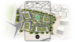
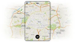
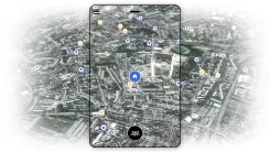
3D mapping: a useful contextual representation
The 3D map view allows a real estate project to be placed within its actual surroundings, highlighting its location, access points, and connections to existing infrastructure. Unlike a standard map, it adds a visual, immersive dimension that makes it easier for all stakeholders—whether investors, partners, or prospective buyers—to understand the project.
A customizable interactive solution
We design interactive maps tailored to your needs and project: project geolocation, placement of urban features, and visualization of urban networks and neighborhood amenities. This approach ensures an effective, simple, and easily understandable representation for your audiences.
An intuitive experience for visualizing, understanding, and communicating.
Thanks to our mapping expertise, you have access to an easy-to-use tool optimized for navigation and project presentation. You can display contextual data, filter information, and navigate the map without sacrificing clarity. This experience enhances your sales presentations and strengthens your ability to present projects to your audiences.

What is an interactive map?
A map-based view is an interactive visualization solution that allows users to navigate a geographic display and view detailed, contextualized information. It serves to locate a project and gain a better understanding of its surroundings.
What is the purpose of interactive mapping?
Interactive mapping is an ideal tool for developers, architects, and urban planners. It allows real estate projects to be presented within their context in a clear and immersive way, making your presentations higher-quality and easier to understand.
Why choose axeon-360 ?
Leveraging our expertise in interactive digital solutions, we develop interactive maps that are both technically rigorous and visually appealing. We create powerful communication tools to support your sales presentations.FAQ – Smart map
Mapping allows you to simultaneously display a real estate project and its contextual data within a single visual environment. This enables your prospects to immediately grasp the development's location, thereby accelerating decision-making and enhancing sales transparency.
Yes. Our interactive maps are optimized for easy integration into any website via iFrame, custom module, or direct integration. They maintain their fluidity and display quality.
It's ideal for real estate projects, subdivisions, urban plans, industrial projects, network layouts, or strategic presentations requiring clear visual understanding.
Depending on the project's complexity, the turnaround time is generally between 5 and 15 days. We can also mobilize our teams on short notice to meet urgent business needs.
The price depends on the area, the level of details, the interactive features expected, and the project complexity. A customized quote is provided to ensure excellent value for money.
We are available at any time to arrange a video conference in order to present our references, analyze your needs, and answer your questions. Please feel free to send us a message using the form opposite :