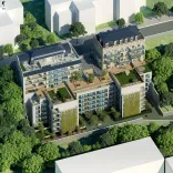
Aerial view
#3D perspective

A comprehensive overview of the project at a glance
The aerial view allows for an instant understanding of the project's structure: buildings, roads, green spaces, traffic flow, and connections with the existing environment. This overview is ideal for presenting a complex project in a simple, fluid, and immediately understandable way.
An essential tool for promotion and decision-making
During the marketing phase, the aerial view becomes a key selling point. It helps buyers visualize the space, investors analyze the project's potential, and partners validate the location choices. It's a clear, concise, and impactful tool.
Aerial views adapted to all your communication media
AXEON-360 delivers optimized aerial views for web, print, construction site signage, tender documents, and sales presentations. Each view is designed to maintain its visual impact, regardless of the medium used.
Technical expertise at the service of readability and precision
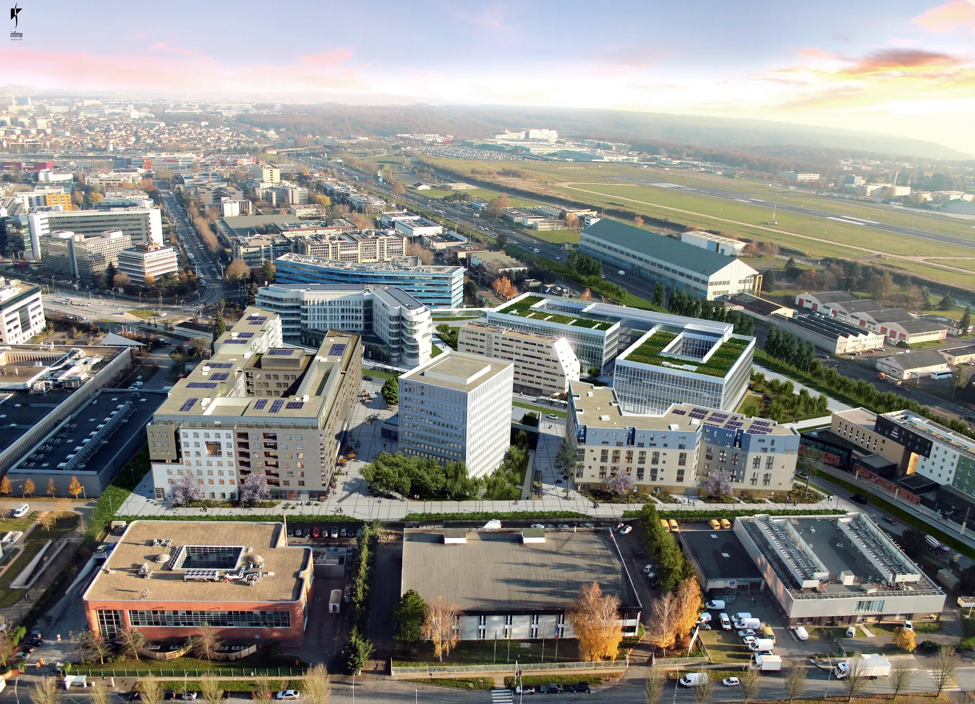
Each aerial view is constructed using reliable architectural data, a precisely modeled site, and meticulous attention to proportions and scale. Our aerial views thus offer a realistic and credible representation, essential for reassuring investors, communities, and buyers about the project's feasibility and quality.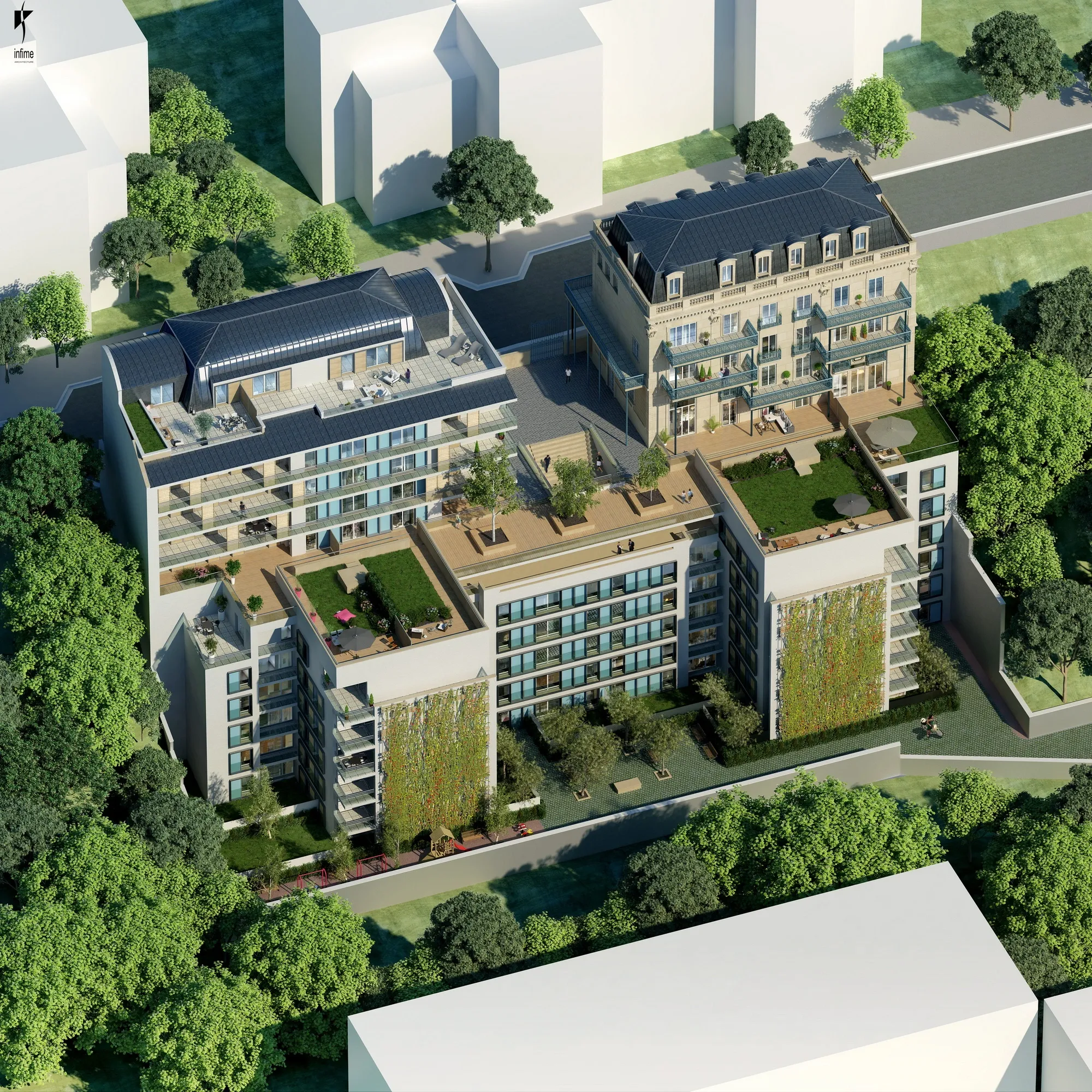
Realistic and perfectly contextualized aerial views
Each aerial view produced by AXEON-360 is based on reliable data and advanced 3D modeling. The terrain, existing buildings, vegetation, and surrounding infrastructure are precisely integrated to offer realistic, credible, and immediately understandable aerial views, far surpassing a simple map or a typical drone view.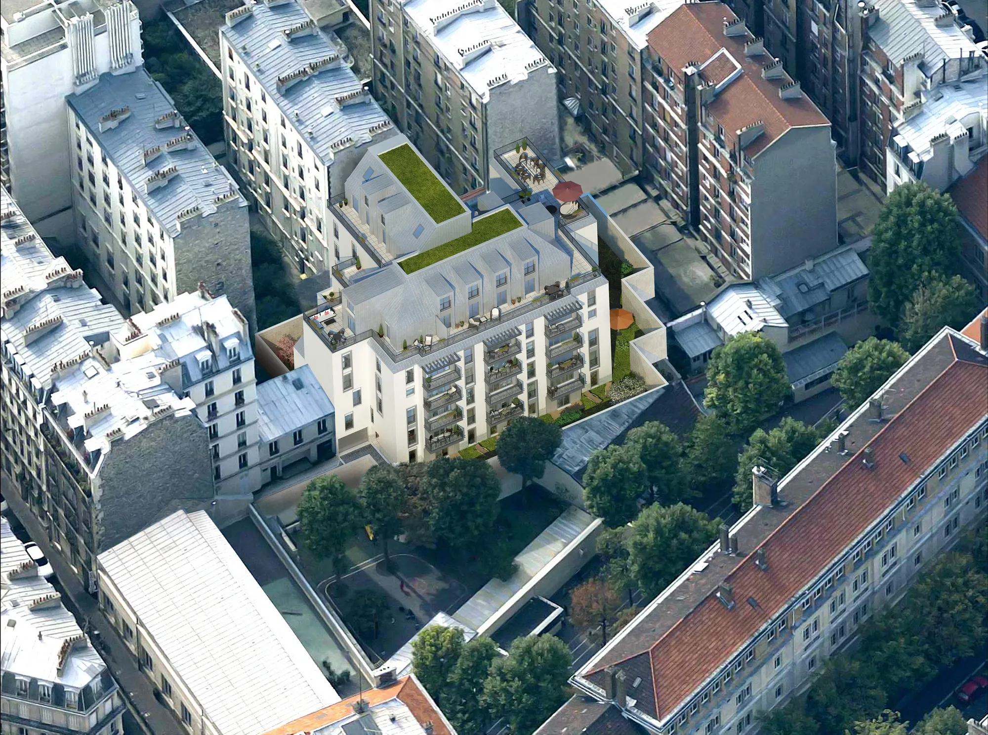
A powerful tool for selling, persuading, and reassuring
Aerial views of real estate projects are now an essential tool for showcasing a project even before construction begins. They reassure potential buyers, convince investors, and accelerate decision-making. AXEON-360 transforms the complexity of a real estate project into a clear, accessible, and engaging aerial representation.FAQ – Aerial views
Aerial view is a 3D representation seen from above, allowing visualization of a project as a whole. It shows the layout of the buildings, the volumes, the circulation patterns, and the overall environment of the site.
Aerial views are used to quickly understand the structure of a project, to enhance its location and to facilitate communication with buyers, investors or institutions.
AXEON-360 offers a photorealistic aerial view, with textures, lighting and environment true to the reality of the site.
We are available at all times to study your project requests and answer your questions. Do not hesitate to send us your message with the form opposite :